Easterday Hot Springs (Lucky Seven Hot Springs)
Near McDermitt, Oregon, United States
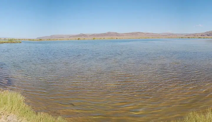
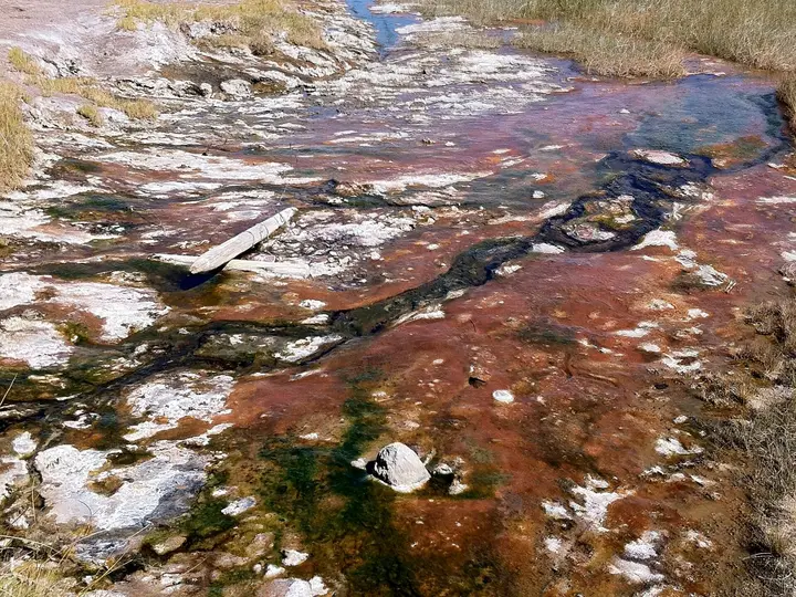
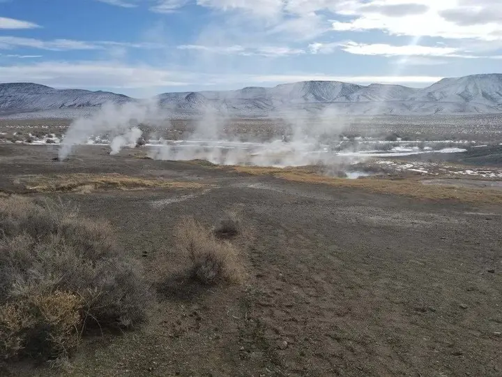
A hot creek fed by seeps in the Hot Spring Hills north of McDermitt, with the ruins of an old resort beside it. The main spring is on private land, and public access is not confirmed.
Closed to the public. No public access we could confirm. Federal land-status data shows the main spring and the old resort site as private land, reached through a ranch gate, and one current soaking guide says trespassing is prohibited and camping is not allowed. Another guide still lists it as BLM land. Do not visit without the landowner's permission.
- Water temperature
- Not published
- Entry
- Free
- Getting in
- 4WD road
- Type
- Wild & natural
- Several seeps in the Hot Spring Hills feed a steaming creek, with the source recorded at 120-126°F49-52°C.
- The Lucky Seven name comes from the nearby Lucky Seven Ranch, and some guides call it McDermitt Hot Springs.
- Foundations and rusting remains of an old hot springs resort stand beside the creek.
- Federal land-status data puts the main spring on private land, surrounded by BLM range.
Current status
Easterday Hot Springs, also called Lucky Seven Hot Springs or McDermitt Hot Springs, is a real and unusual spring, but we cannot point you to a legal way in. Federal land-status data shows the main spring and the remains of the old resort on a private parcel, with BLM range land around it. The route in passes a ranch and a gate. One soaking guide says the area is private, trespassing is prohibited and camping is not allowed.
Another soaking guide still lists the springs as BLM land with free dispersed camping. That description does not match the federal data, and we think it is out of date or describes the wider area rather than the springs themselves. Some of the hot creek may run onto public land downstream, but we could not confirm where the boundary falls or how you would reach it without crossing private ground.
So the honest status is this: no public access we could confirm. If you want to soak here, find the landowner first and ask. Without permission, choose another spring.
What to expect
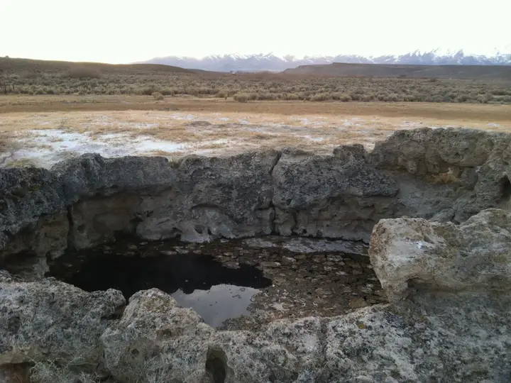
The springs rise as several mineral seeps in the Hot Spring Hills, a low range in the sagebrush desert north of the Nevada line. The largest outflow forms a steaming hot creek that was long ago diverted into a man-made channel. The source has been recorded at about 120 to 126°F49 to 52°C, with a flow of roughly 264 gallons a minute, and the water has no noticeable smell.
Because the source is too hot to sit in, soaking here has always meant walking downstream until the creek cools. One 2024 visitor said the source is uphill from the old resort ruins and close to the road, and suggested walking along the uphill side of the stream for a quarter to half a mile to find a comfortable spot. Much of the channel is only about a foot deep, so people have stacked rocks or dug into the sediment to make deeper spots, and some sections were once proper bathing pools.
The ruins are part of the character of the place. Weathered foundations and rusting structures from an old hot springs resort stand near the creek. Nothing on site is maintained. There are no toilets, trash cans, shade or signs.
Getting there
These directions describe the area so you can recognise it. They are not an invitation to cross private land.
From McDermitt, on the Oregon and Nevada line, drive about 4.5 miles north on US 95 to Easterday Road (also mapped as Hot Springs Road), which leaves the highway to the west between mileposts 117 and 118. From the north, it is about 51 miles south of the US 95 and OR-78 junction. A soaking guide describes the rest of the old route as about 3 miles of dirt: past a ranch, through a gate that must be closed behind you, and on along a rough track to the springs. A high-clearance vehicle is recommended, and the road can become impassable in wet weather.
When to go
If you do get permission, the cool months make the most sense. Desert summers here are hot and dry, and a hot creek is not much relief at midday in July. Late fall and early spring bring comfortable air temperatures, but also the rain and snowmelt that turn dirt roads to mud. Check the forecast and avoid driving in after storms.
Rules and etiquette
- Get permission first. This is the rule that matters. Ask the landowner before you go and follow their conditions.
- Close every gate you open. Cattle graze this country.
- Stay on existing tracks. Do not drive across the desert to reach the creek.
- Leave the ruins alone. Do not climb on or take anything from the old resort structures.
- Pack out everything, including trash and human waste.
- No soap or shampoo in the creek.
Older guides describe the springs as clothing optional, but with no confirmed public access, plan as if you are a guest on someone’s ranch.
Where to stay nearby
There is no camping at the springs.
- McDermitt is the nearest town, a few miles south on US 95 at the state line, with basic services. One guide lists a motel there, about 8 miles from the springs.
- Winnemucca, Nevada, is the nearest larger town, more than an hour south on US 95, with a full range of motels and services.
- BLM land surrounds the private parcel, and dispersed camping is generally allowed on BLM land. Use a land-status map or app to make sure you are on public ground before you set up.
Safety notes
- Scalding source. At up to about 126°F52°C, the source and the creek near it can burn. Test the water with a hand before you step in, and move downstream until it is comfortable.
- Shallow, muddy channel. Soft sediment and old structures make footing uneven. Wear shoes you can get wet.
- Old ruins. Collapsed buildings and rusting metal can hide sharp edges and holes. Keep children and dogs well away.
- Remoteness. This is open desert with long distances between services. Fill up in McDermitt or Winnemucca, carry water and a spare tire, and tell someone your plans.
- Rattlesnakes are common in warm months. Watch where you step around rocks and brush.
Nearby options
If you came to southeast Oregon for a soak, public options are a long drive west. Alvord Hot Springs, at the edge of the Alvord Desert below Steens Mountain, is the best-known paid soak in the region and has camping. It is a long drive from McDermitt, partly on gravel, so check that page for directions and current hours before you set out.
Map and nearby springs
GPS: 42.08098, -117.76032
Easterday Hot Springs (Lucky Seven Hot Springs): common questions
Is Easterday Hot Springs on public land?
Mostly no. Federal land-status data shows the main spring and old resort site on a private parcel, with BLM land around it. One soaking guide says the area is private and trespassing is prohibited. Another lists the site as BLM land, so sources conflict, but we found nothing that confirms public access.
Why is it called Lucky Seven Hot Springs?
The springs are near the Lucky Seven Ranch, and the name stuck. The same place is also listed as Easterday Hot Springs, after Easterday Road, and as McDermitt Hot Springs.
How hot is the water at Easterday Hot Springs?
The source has been recorded at about 120 to 126°F49 to 52°C, too hot to soak in. The water cools as it runs down the creek channel, and visitors have described walking a quarter to half a mile downstream to find a comfortable temperature.
Where is Easterday Hot Springs?
In the Hot Spring Hills in far southeast Oregon, a few miles north of McDermitt and the Nevada line. The access is Easterday Road, which leaves US 95 to the west about 4.5 miles north of McDermitt, between mileposts 117 and 118.
Can you camp at Easterday Hot Springs?
Not at the springs. One current guide says camping is not allowed because the site is on private land. If you want to camp in the area, use BLM land away from private parcels, and check a land-status map first.
Closest hot springs to Easterday Hot Springs (Lucky Seven Hot Springs)
100-104°F38-40°C
Wild & natural
Willow Creek Hot Springs (Whitehorse Ranch Hot Springs)
Oregon, United States
29 mi away, ~45 min drive
100-104°F38-40°C Free Drive-up
Near Jordan Valley
Wild & natural
All hot springs in OregonAll hot springs in United StatesOpen the full map