Trego Hot Springs
Near Gerlach, Nevada, United States
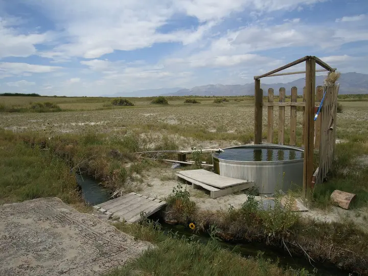
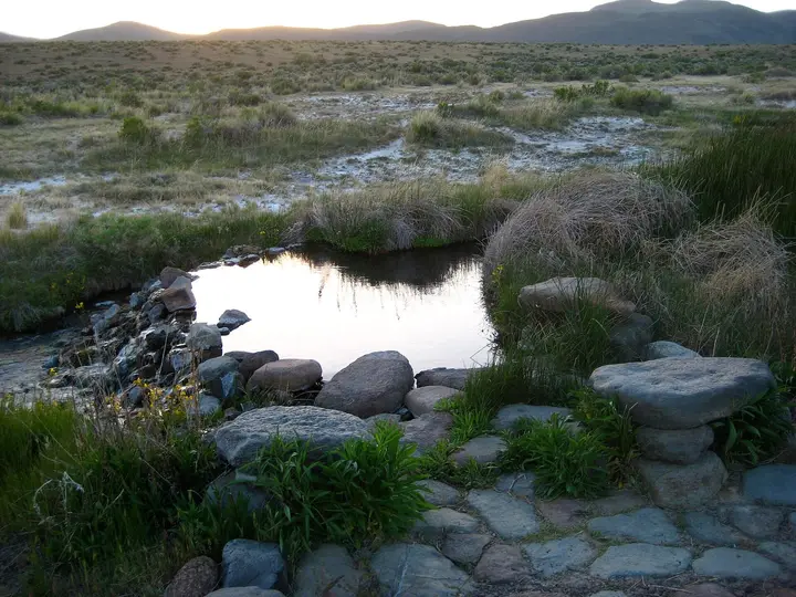
A long, mud-bottomed hot ditch beside the railroad on the east edge of the Black Rock Desert. Free BLM land you can drive to, but the BLM has advised against any contact with the water since 2020.
Photos: NPS Staff ( Photo Credit: NPS ) (Public domain); Mitch Barrie from Reno, NV, USA (CC BY-SA 2.0). Resized and cropped for this page.


- Water temperature
- Not published
- Entry
- Free
- Getting in
- Drive-up
- Type
- Wild & natural
- In June 2020 the BLM reported E. coli, fecal coliforms and Vibrio cholerae in the water and told the public to avoid all bathing and contact. No public notice lifting that advice has been found.
- The spring rises at the north end by the railroad tracks and runs south as a long ditch with a soft mud bottom.
- You can drive to the edge of it on dirt roads off Jungo Road, with no playa crossing needed.
- Free camping, but BLM rules for the NCA allow vehicle camping at Trego only in designated sites, with a 14-day limit.
What to expect
Trego Hot Springs is not a pool. It is a long ditch of hot water cutting across flat, pale desert on the east side of the Black Rock Desert, right beside the railroad that runs from Gerlach toward Winnemucca. The spring comes up at the north end, near the tracks, and the water flows south along the ditch. The bottom is soft mud, and it clouds up the moment you step in.
For years Trego was the Black Rock spring people actually swam in. Friends of Black Rock-High Rock, the stewardship group that works with the BLM, still calls it the only hot spring in the area where people can swim. Its source is far too hot to touch, and the water only becomes bearable after it has run some distance down the ditch.
The problem is the water itself. In June 2020 the BLM’s Black Rock Field Office announced that tests had found E. coli, fecal coliforms and Vibrio cholerae, the bacterium behind cholera. The agency said the springs may pose a severe risk to human health and advised the public to avoid bathing or any contact with the water. It blamed contamination from wildlife and livestock, and noted that warning signs it had posted were sometimes vandalized or torn down. We could not find any later notice lifting the advisory, and Travel Nevada’s hot springs page still tells people not to enter the water. Until the BLM says otherwise, treat Trego as a place to look at and camp near, not a place to soak.
There are no facilities of any kind: no toilets, no water, no shade and no trash cans.
History
People used this spot long before the railroad. Archaeologists date seasonal occupation here to roughly 4000 to 1000 years ago. In 1856 two men taking a shortcut across the playa found the springs, and emigrants on the Nobles route followed them. In 1860 Frederick Lander’s road crew dug a 400-foot trench to cool the water into a large tank for travelers.
The name Trego came with the Western Pacific Railroad in the early 1900s, when a station stood here. Friends of Black Rock-High Rock says the present ditch formed when railroad construction struck water. In 1993 the site hosted Desert Siteworks, a small art gathering whose Leave No Trace principles were later taken up by Burning Man.
Getting there
Gerlach is the jumping-off point, about 105 miles north of Reno by I-80 and NV-447. From Gerlach, take Jungo Road east. It is graded dirt and gravel. The BLM places the springs about 20 miles northeast of Gerlach, on the north side of Jungo Road next to the railroad. Short dirt tracks lead to the ditch. The railroad crossings out here are unmarked, so stop and look both ways every time.
You can also reach Trego across the dry playa from the 12-mile access road north of Gerlach, heading east. Only do that when the playa is completely dry. A little rain turns the lakebed into deep, sticky mud.
Floods have closed these roads before. In March 2019 the BLM shut the roads into the Trego area after flooding left a vehicle stuck. The springs stayed open on foot, and the agency reminded visitors that off-road driving at Trego is not allowed because it damages archaeological sites and rare plants. A normal car can usually manage Jungo Road when it is dry; carry a spare tire and plenty of water.
When to go
Spring and fall are the comfortable seasons. Summer days on the playa are very hot with no shade, and winter brings cold nights and the occasional storm that makes the dirt roads impassable.
Plan around Burning Man. The BLM’s 2023 to 2027 closure order for the event has two phases. The smaller Phase 1, for build and teardown, is well to the west. The larger Phase 2, about 20 days covering six days before the event, the event itself and five days after, includes the part of section 31 (T34N R26E) that lies inside the conservation area. BLM maps place Trego in that strip. Expect the area to be closed or swamped with traffic in late August and early September, and check the closure map the BLM publishes each summer.
Rules and etiquette
Trego sits inside the Black Rock Desert-High Rock Canyon Emigrant Trails National Conservation Area, run by the BLM’s Black Rock Field Office in Winnemucca (775-623-1500).
- No fees. Commercial, competitive or organized group trips need a BLM Special Recreation Permit.
- Stay limit: 14 days.
- Vehicles: existing roads only. No off-road driving around the springs.
- Camp back from the water. Friends of Black Rock-High Rock asks for no camping within 300 feet of any spring. That is the group’s guidance rather than a posted BLM rule, but it keeps the water cleaner and leaves room for others.
- Clothing: nudity has long been common at remote Black Rock springs. Given the advisory, the question is mostly moot.
- Pack it out. That includes human waste. Bring a portable toilet or bags.
- Fires: not directly on the playa surface. Check current BLM fire restrictions in summer.
Where to stay nearby
Most people camp. Under the BLM supplementary rules for the NCA, vehicle camping at Trego is allowed only in designated sites, so use the marked spots rather than pulling off anywhere along the ditch. Gerlach, about 20 miles back down Jungo Road, is the nearest town and has limited services; Friends of Black Rock-High Rock keeps an office there with current road and playa information. For a motel and full services, Winnemucca is to the east, at the far end of Jungo Road, and Reno is about two hours south of Gerlach.
Black Rock Hot Springs is across the playa at the foot of Black Rock Point, and Double Hot Springs is north of it. Both are far too hot to enter. If you want a soak in this corner of Nevada, look at Soldier Meadows, farther north, and check its listing for current access rules.
Safety notes
- Bacteria: The 2020 BLM advisory is the main risk. Keep water out of your mouth, eyes, nose and any cuts. Do not let children or dogs splash in it.
- Scalding: The source has been measured at 187°F86°C. You cannot judge temperature by looking, and the mud bottom hides hotter inflows. The steep, slick banks are their own hazard.
- Remoteness: There is little or no cell signal. Carry water, fuel, a spare tire and a way to call for help, and tell someone your route.
- Weather: Thunderstorms and dust storms move fast on the playa. Leave before a storm turns the roads to mud.
- The railroad: Trains run on this line. Never park on or near the tracks.
Map and nearby springs
GPS: 40.77125, -119.11604
Trego Hot Springs: common questions
Is it safe to swim at Trego Hot Springs?
The BLM says no. In June 2020 its Black Rock Field Office reported that the water tested positive for E. coli, fecal coliforms and Vibrio cholerae, and it advised the public to avoid bathing or any contact with the water. The agency said contamination usually comes from wildlife and livestock. Warning signs have been posted before and torn down. We found no notice lifting the advisory, and Travel Nevada still repeats it.
How do you get to Trego Hot Springs?
From Gerlach, take the graded dirt Jungo Road east. The BLM puts the springs about 20 miles northeast of town. They are on the north side of the road beside the railroad, and you reach them on short dirt tracks. You can also drive across the Black Rock playa from the 12-mile access road north of Gerlach, which means crossing the railroad at unmarked crossings.
How hot is Trego Hot Springs?
The source is very hot. A 1979 state survey cited on Wikipedia recorded 187°F86°C, which is close to boiling at this elevation. The water cools as it flows south along the ditch, but no current soaking temperature has been published, so test any spot carefully with a thermometer.
Can you camp at Trego Hot Springs?
Yes, in designated sites only. The 2008 BLM supplementary rules for the Black Rock Desert-High Rock Canyon NCA name Trego Hot Springs as an area where vehicle camping is allowed only in designated sites. There is no fee and a 14-day limit. Friends of Black Rock-High Rock asks visitors not to camp within 300 feet of the springs. Stay on existing roads; the BLM does not allow off-road driving at Trego.
Is Trego Hot Springs closed during Burning Man?
Possibly, for part of it. The BLM legal description of the larger Phase 2 closure for 2023 to 2027 includes the part of the section around Trego that lies inside the NCA, which is where federal maps place the spring. Phase 2 lasts about 20 days around the event. Check the closure map the BLM posts each summer before you go.
Closest hot springs to Trego Hot Springs
Near Gerlach
Wild & natural
Soldier Meadows Hot Springs
Nevada, United States
41 mi away, ~1 hr drive
95-112°F35-44°C Free 4WD road
100-110°F38-43°C
Wild & natural
Eagleville Hot Springs (Squaw Baths)
California, United States
58 mi away, ~1.5 hr drive
100-110°F38-43°C Free Short walk
Near Denio Junction
Wild & natural
Near Unionville
Wild & natural
All hot springs in NevadaAll hot springs in United StatesOpen the full map
Sources we checked (6)
- blm.gov/press-release/trego-hot-springs-may-pose-severe-risk-human-health
- blm.gov/press-release/trego-hot-springs-recreation-area-road-closure
- en.wikipedia.org/wiki/Trego_Hot_Springs
- blackrockdesert.org/hot-springs
- federalregister.gov/documents/2023/06/20/2023-13016/temporary-closure-and-restrictions-of-specific-uses-on-public-lands-for-the-burning-man-event
- openstreetmap.org/node/3694731387