Montecito Hot Springs
Near Montecito, California, United States
A string of small, volunteer-built soaking pools in a creek bed above Montecito, beside the ruins of a 19th-century resort, reached by a steady 1.3-mile climb on the Hot Springs Trail.
- Water temperature
- Not published
- Entry
- Free
- Getting in
- Hike in
- Type
- Wild & natural
- Pools sit beside the stone ruins and exotic garden plantings of a resort that burned in the 1964 Coyote Fire.
- The hike is short but climbs about 800 feet, with ocean views on the way down.
- Tow-away zones on East Mountain Drive and Riven Rock Road have been enforced since October 2025.
- The Forest Service lets the existing pools stay but does not allow new ones, and has cited people for rebuilding them.
What to expect
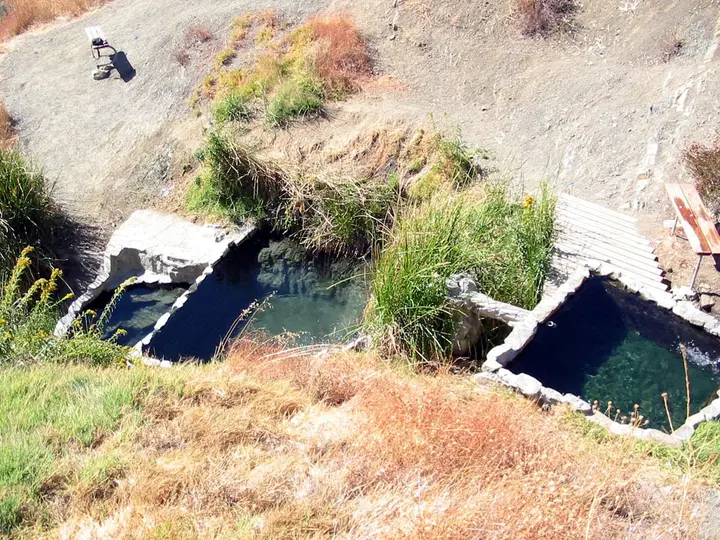
Montecito Hot Springs sits at about 1,485 feet in Hot Springs Canyon, in the Santa Ynez Mountains above Montecito. Warm water seeps out of the sandstone in several places and runs down a rocky creek bed, and volunteers have stacked rocks and mortar into a chain of small pools that step down the slope. Wikipedia cites a 2022 guidebook describing eight cascading pools. The number and shape change from year to year, because winter storms wash some out and people rebuild them.
The pools are small and shallow. Most hold two to six people, and the best ones fill fast on weekends. The water has a sulfur smell. At the sources it was measured at about 111-118°F44-48°C in 1914, and the pools further down are cooler because the hot water mixes with creek flow. Expect a range from warm bath to barely warm, depending on which pool you pick and the season.
What gives the place its character is the setting. A resort operated here off and on from the 1850s, with a three-story hotel, bathhouses and later a private club. Fires burned it in 1871, 1920 and 1921, and the 1964 Coyote Fire finished it off. You walk past stone foundations, old walls and bamboo, palms and other plantings left from the resort gardens. Since 2013 the old resort land has been part of Los Padres National Forest, after a land trust bought the canyon from the McCaslin family.
There are no toilets, trash cans or drinking water on the trail.
Getting there
From US-101 in Montecito, head uphill toward the mountains on the residential roads to East Mountain Drive; a map app is the easiest way through the maze of lanes. From downtown Santa Barbara, the Trails Council suggests heading east on Alameda Padre Serra and continuing onto Mountain Drive. The trailhead is near the junction of East Mountain Drive and Riven Rock Road.
Parking is the hardest part of the trip. The county lot holds about eight cars and is open from 8 am to sunset. Since October 2025 the Sheriff’s Office and CHP have towed cars from signed zones on East Mountain Drive and Riven Rock Road. Some stretches are no parking at any time, some are no parking from sunset to 8 am, and some are no parking during Red Flag Warnings. Oversized vehicles are banned in marked zones. These are narrow residential roads that double as wildfire evacuation routes, so do not block driveways or squeeze onto the shoulder. The Trails Council encourages carpooling, a taxi or a bike.
The trail climbs steadily up the canyon on a mix of old road and singletrack, through oak woodland and chaparral. The Trails Council lists it at 2.6 miles out and back with about 793 feet of gain. There are a few junctions, including connectors toward the Cold Spring Trail, so carry a map. Shade is limited on the upper half.
When to go
The trail is open year-round, but the conditions change a lot by season.
Winter and spring are the best months. The air is cool, the creek runs, and the warm water feels warmer. The drawback is storm damage: big rains can wash out pools and make the creek crossings messy. Supervisors asked in 2025 for the trail and lot to be closed after heavy rain, so expect closures after storms.
Summer afternoons are hot on the exposed climb, and the pools feel tepid.
Fall brings Sundowner winds and Red Flag Warnings. On those days the lot and nearby roads are closed to parking, and the county has paid for extra patrols. Check the National Weather Service Los Angeles/Oxnard forecast before you go.
Since a TikTok video went viral in 2020, weekends have been crowded. Weekday mornings right at 8 am give you the best chance of a parking space and a pool.
Rules and etiquette
The canyon is national forest land surrounded by private homes, and local tension over the pools, crowds and parking is real. The rules that matter:
- Day use only. The lot closes at sunset, and overnight street parking near the trailhead gets towed. No camping on the trail.
- No fire of any kind. No campfires, candles, torches or smoking. Residents and county officials have reported torches and fires on the trail, and this is one of the most fire-prone corners of the county.
- Do not build or rebuild pools. The Forest Service lets the existing pools remain but will not approve new ones, and in February 2025 officers cited a visitor for moving stones to repair one.
- Clothing varies. Most visitors wear swimsuits because the trail is busy, but nudity does happen. Forest Service officers do patrol.
- No soap or glass. Pack out everything, including food waste.
- Respect the neighbors. Keep noise down at the trailhead and stay off private driveways and side lanes.
Where to stay nearby
There is no camping in the canyon. The nearest choices:
- Montecito and Santa Barbara have hotels and inns at every price level, from roadside motels on upper State Street to the beach resorts along Channel Drive. The trailhead is a short drive from downtown Santa Barbara.
- Carpinteria State Beach, about 20 minutes southeast on US-101, is the closest large public campground.
- The Santa Ynez River recreation area, over San Marcos Pass off State Route 154, has several Los Padres National Forest campgrounds and is the route to Big Caliente and Little Caliente hot springs. Both were closed by a Forest Service order after storm damage from September 16, 2026 to September 15, 2027, so check before you go.
Safety notes
- Fire: This is the biggest risk here. Leave if smoke or a fire is reported, and never smoke on the trail.
- Water quality: The pools are small, warm and heavily used. Keep your head out of the water and do not drink it.
- Heat: The climb is exposed in summer. Bring more water than you think you need.
- Footing: Algae makes the rocks around the pools slick, and the creek bed is uneven. Wear proper shoes.
- Flash floods and debris: After heavy rain the canyon can carry fast water and loose rock. Stay out during and right after storms.
- Poison oak grows along parts of the trail.
Nearby stops worth adding
The Cold Spring Trail starts a short way west on East Mountain Drive and is another canyon walk with a creek alongside. For a longer day, Montecito Peak is a steep climb reached from the Cold Spring area with wide views over the coast and the Channel Islands. Down in town, Butterfly Beach below Channel Drive is an easy place to rinse off after the hike.
Map and nearby springs
GPS: 34.46348, -119.64044
Montecito Hot Springs: common questions
How long is the hike to Montecito Hot Springs?
The Santa Barbara County Trails Council lists the Hot Springs Canyon Trail as 2.6 miles out and back with about 793 feet of climbing, rated moderate.
Where do you park for Montecito Hot Springs?
There is a small county lot with about eight spaces near the junction of East Mountain Drive and Riven Rock Road. It is open from 8 am to sunset. Nearby streets have signed tow-away zones, some with no parking at any time and some with no parking from sunset to 8 am. If your car is towed, call Sheriff Dispatch at 805-681-4100.
Is Montecito Hot Springs open on Red Flag days?
Parking near the trailhead is restricted when the National Weather Service issues a Red Flag Warning, and the county has closed the lot on such days. Fire danger is the main reason access is limited, so check the forecast before you drive up, especially during fall Sundowner wind events.
How hot are the Montecito Hot Springs pools?
Temperatures vary from pool to pool and change after storms, so there is no fixed figure. Historical measurements recorded the spring sources at about 111-118°F44-48°C in 1914. The pools downstream mix with creek water and are cooler.
Are the pools at Montecito Hot Springs legal?
The pools were built by volunteers without permits. Los Padres National Forest has said it will not remove the existing pools, which it treats as an established recreational use, but it will not approve new ones. In early 2025 Forest Service officers cited a visitor for moving rocks to rebuild a pool, so leave them as you find them.
Closest hot springs to Montecito Hot Springs
Little Caliente Hot Springs
California, United States
5 mi away, ~10 min drive
105-109°F41-43°C Free Long hike
115°F46°C
Wild & natural
98-105°F37-41°C
Resort or spa
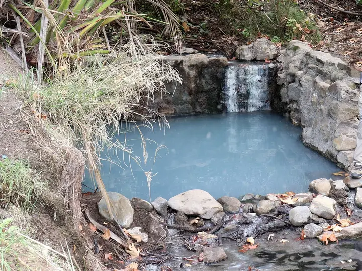
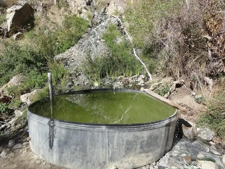
Willett Hot Springs
California, United States
34 mi away, ~55 min drive
100-103°F38-39°C Paid Long hike
Near Ojai
Wild & natural
All hot springs in CaliforniaAll hot springs in United StatesOpen the full map
Sources we checked (6)
- santabarbaratrails.org/trails/montecito-valley/hot-springs-canyon-trail/
- en.wikipedia.org/wiki/Montecito_Hot_Springs
- edhat.com/news/santa-barbara-county-announces-parking-restrictions-near-hot-springs-trailhead/
- noozhawk.com/county-will-restrict-parking-at-hot-springs-trail-during-red-flag-days/
- noozhawk.com/santa-barbara-county-moves-to-hike-up-enforcement-for-hot-springs-trail/
- noozhawk.com/bill-macfadyen-montecitos-hot-springs-at-center-of-cold-war-over-trail/