Lemon Hot Spring
Near Placerville, Colorado, United States
A warm spring that drains from an old mine tunnel into a small pond among private homes across the San Miguel River from Placerville, with no public access or soaking facilities.
Closed to the public. Not a public soaking site. The spring drains from an old mine adit into a small pond surrounded by private homes across the river from Placerville, and federal land-status data shows the site as private.
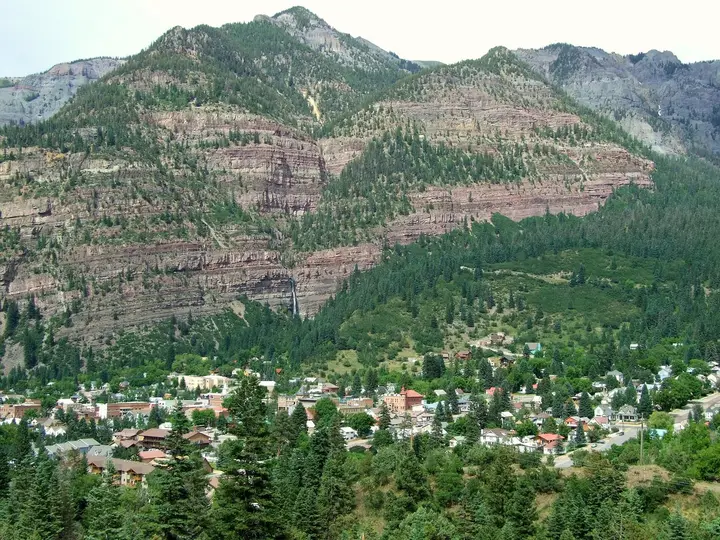
Photo: Jeffrey Beall (CC BY 4.0). Resized and cropped for this page.

- Water temperature
- Not published
- Entry
- Paid
- Getting in
- Drive-up
- Type
- Wild & natural
- State geologists described it as a 20-foot pond at the mouth of an old mine adit, ringed by private residences.
- Federal surface management data shows the mapped point on private land.
- Older federal records put the water at roughly 91-93°F33-34°C, warm rather than hot.
- Orvis Hot Springs near Ridgway and Dunton Hot Springs are the closest places to soak legally.
What to expect
Lemon Hot Spring is a geology record more than a place to visit. It turns up in Colorado Geological Survey reports, in the US Geological Survey’s mineral resources database and on Wikipedia’s list of Colorado hot springs, which is why its name appears on some soaking maps. When you look at what those records actually describe, though, there is nothing here for a visitor.
The most useful description comes from the Colorado Geological Survey’s 1992-1993 low-temperature geothermal assessment. The geologist who visited in July 1993 found a pond about 20 feet across at the mouth of an old mine adit, with the spring water draining out of the tunnel into it. Several buildings that looked like private homes surrounded the pool and the tunnel entrance. The pond was choked with weeds and algae, and the owners could not be reached to discuss it.
That picture fits the land records. When we checked the mapped coordinates against the Bureau of Land Management’s national surface management data, the point fell on private land. The spring sits inside a small residential area across the river from Placerville, not on open public ground. For that reason this listing is marked as not open, and we do not give directions to the spring itself.
The water
Records disagree a little, as they often do for minor springs. The USGS mineral resources database, drawing on a Colorado Geological Survey bulletin, lists it at about 93°F34°C with a flow of about 8 gallons per minute. Other datasets based on a 1978 USGS sample give about 91°F33°C. That works out to roughly 91-93°F33-34°C, a few degrees below body temperature. Water that cool would feel pleasant on a hot day but chilly on a mountain evening.
The water is mineral-rich, with high sulfate and sodium in the older analyses, and the spring sits on a fault zone that geologists have studied. In 2012 the area was included in a geothermal database prepared for exploration around Rico and Lemon Hot Springs, as part of a look at the region’s deeper heat. None of that work involved developing a pool for the public.
Why it is on our list
Hot spring directories often pull names straight from government datasets. A spring with “Hot” in its name and a set of coordinates looks like a soaking spot on a map, even when it is a weedy pond in someone’s yard. We include Lemon so that anyone who comes across the name can get a clear answer before driving out to Placerville. If you are in the Telluride area and want to soak, head for one of the established springs below.
Getting there
We are not giving directions to the spring because it is on private residential property. For context only: Placerville is a tiny community in the San Miguel River canyon where Colorado Highway 145 meets Highway 62, about 15 miles northwest of Telluride. Highway 62 climbs east from there over the Dallas Divide to Ridgway, and Highway 145 follows the river downstream toward Norwood and Naturita. Both highways are paved and open year-round, though the Dallas Divide can be snowy and icy in winter.
If you pass through, please do not drive into the residential roads across the river looking for the spring. Residents there are not running a public attraction.
When to go
There is no public season, because there is no public site. If you are planning a soaking trip in this part of the San Juans, the best months for driving are June to October, when mountain passes are clear and the aspens are out in late September. Winter brings good soaking weather at the developed springs but harder driving on the passes.
Rules and etiquette
- Stay off private land. The spring and the pond are surrounded by homes. Trespassing is illegal and can get you cited.
- Do not trust app pins. Some soaking apps list Lemon as public land. The federal land status data and the state geologists’ description say otherwise.
- Use established springs. Several commercial and resort hot springs within an hour’s drive welcome visitors, as long as you follow their booking rules.
Where to soak and stay nearby
- Orvis Hot Springs: south of Ridgway, roughly 30 to 40 minutes from Placerville over the Dallas Divide. A long-running commercial spring with several pools.
- Dunton Hot Springs: a historic ghost-town resort in the West Dolores valley, reached from Highway 145 south of Telluride via Lizard Head Pass. Check current access rules with the resort before you go.
- Ouray: about 20 minutes beyond Ridgway, with a large public hot springs pool and several hotels with soaking pools.
- Telluride: about 15 miles southeast of Placerville, the nearest town with a full choice of lodging and restaurants. Matterhorn Campground, a national forest campground on Highway 145 below Lizard Head Pass, is the closest developed campground.
Safety notes
- Private property: the main risk here is legal, not physical. Respect “No Trespassing” signs and residents’ privacy.
- Water quality: even if access were allowed, a warm, weedy, slow-moving pond at a mine adit is not a place to put your head under. Old mine tunnels can carry metals and other contaminants.
- Mine openings: never enter old adits or tunnels anywhere in the San Juans. They can hold bad air, unstable rock and deep water.
- Mountain roads: watch for rockfall in the San Miguel canyon and for ice on the Dallas Divide from autumn to spring.
Map and nearby springs
GPS: 38.01528, -108.05361
Lemon Hot Spring: common questions
Can you soak at Lemon Hot Spring?
No, not legally as far as any source shows. The spring sits within a small residential area across the San Miguel River from Placerville, and federal land data marks the site as private. There is no operator, no public pool and no documented public access. Do not walk onto private property to look for it.
Where is Lemon Hot Spring?
In San Miguel County in southwest Colorado, on the opposite bank of the San Miguel River from Placerville, near where Highways 145 and 62 meet. It sits at roughly 7,300 feet. The coordinates come from Colorado Geological Survey and federal place-name records.
How warm is Lemon Hot Spring?
Older records put it at about 91-93°F33-34°C, or roughly 91-93°F33-34°C, which is below body temperature. A 1993 state survey found the pond choked with weeds and algae. It is a warm spring, not a hot one.
Where can I soak near Placerville and Telluride instead?
Orvis Hot Springs, south of Ridgway, is the nearest established option, about 30 to 40 minutes from Placerville over the Dallas Divide. Dunton Hot Springs, a private resort in the Dolores River valley, is another, though its access rules change, so check with the operator first.
Is Lemon Hot Spring the same as Geyser Warm Spring?
No. Some old state records label Lemon with "Geyser" in brackets, and the nearby roads carry similar names, but Geyser Warm Spring is a separate spring near Dunton in Dolores County.
Closest hot springs to Lemon Hot Spring
85-106°F29-41°C
Resort or spa
82°F28°C
Wild & natural
98-114°F37-46°C
Resort or spa
Box Canyon Lodge & Hot Springs
Colorado, United States
21 mi away, ~30 min drive
Temp n/a Paid Drive-up
100-106°F38-41°C
Resort or spa
Twin Peaks Lodge & Hot Springs
Colorado, United States
21 mi away, ~30 min drive
100-106°F38-41°C Paid Drive-up
All hot springs in ColoradoAll hot springs in United StatesOpen the full map
Sources we checked (5)
- coloradogeologicalsurvey.org/wp-content/uploads/woocommerce_uploads/OF-95-01.pdf
- mrdata.usgs.gov/mrds/show-mrds.php
- en.wikipedia.org/wiki/List_of_hot_springs_in_Colorado
- gis.blm.gov/arcgis/rest/services/lands/BLM_Natl_SMA_LimitedScale/MapServer
- osti.gov/dataexplorer/biblio/1148736-geothermal-geodatabase-rico-hot-springs-area-lemon-hot-springs-dolores-san-miguel-counties-colorado